Uploads by Volunteer8
Jump to navigation
Jump to search
This special page shows all uploaded files.
| Date | Name | Thumbnail | Size | Description |
|---|---|---|---|---|
| 12:15, 3 July 2019 | Public Square 1930 Wooster, Ohio map.jpg (file) |  |
36 KB | This map is of public square in 1930. People Saving's Building 121-129 had various businesses in the building. The locations of the offices are listed under separate heading by office number. |
| 11:43, 29 May 2019 | Public Square 1923 Wooster, Ohio map.jpg (file) |  |
46 KB | test |
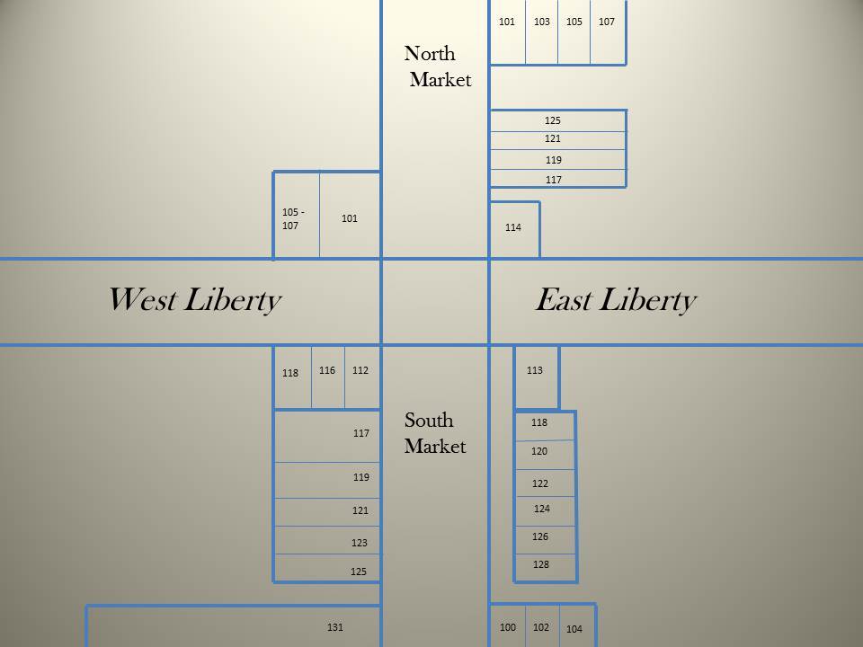
| 13:36, 24 April 2019 | Public Square 1923 Wooster Ohio map.jpeg (file) |  |
40 KB | This is first year that the addresses were changed to new address numbers. Bldg. sizes are in approximate locations as indcated on Sanborn fire maps. There were some addresses that were listed in the 1925 directory that were not drawn on the 1923 Sanbo... |
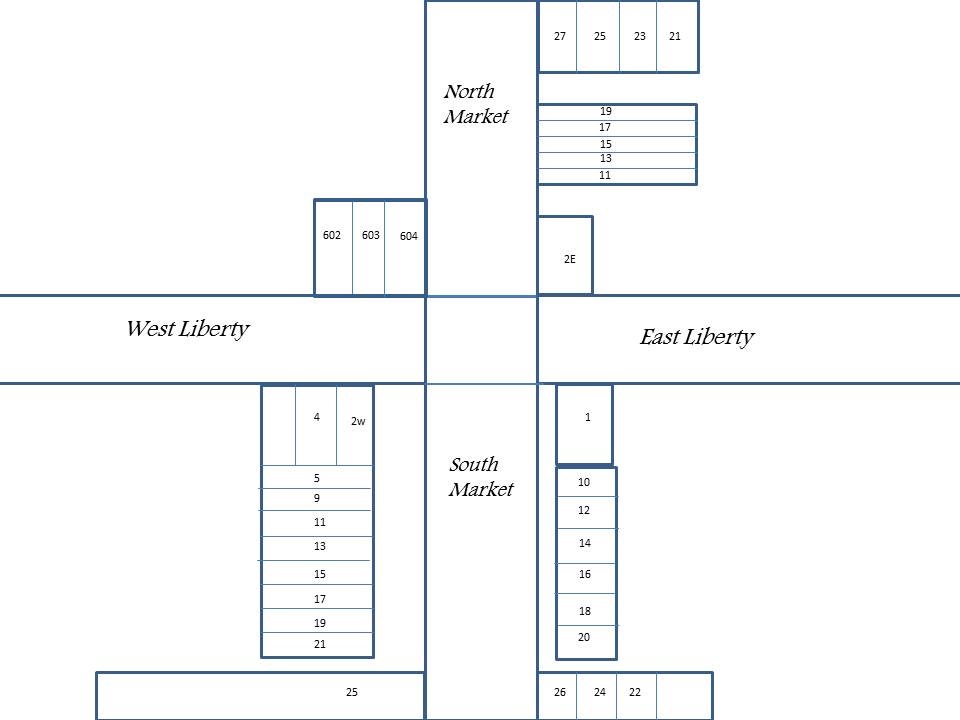
| 11:14, 20 March 2019 | PS 1912-1913 PSqmapwiki.jpg (file) |  |
68 KB | Map does not indelicate actual size of buildings, only locations. Numbers on map refer to actual addresses, in directory and on listing here. |
| 12:13, 27 February 2019 | PS 1908-1909 PSqmapwiki.jpg (file) |  |
68 KB | |
| 11:23, 22 August 2018 | 1900 Wooster Ohio map.jpg (file) |  |
46 KB | This map created to show approximate locations of Wooster Public Square businesses in the year 1900. Numbers in listing refer to numbers of the map buildings. |
| 13:07, 16 May 2018 | PS 1894-1895PSqmap4wiki.jpg (file) |  |
45 KB | This map approximates locations of businesses on Wooster Public Square in 1894-1895. Building sizes may be slightly off as well as precise locations of businesses due to lack of immediate information. Business locations have been approximated and desig... |
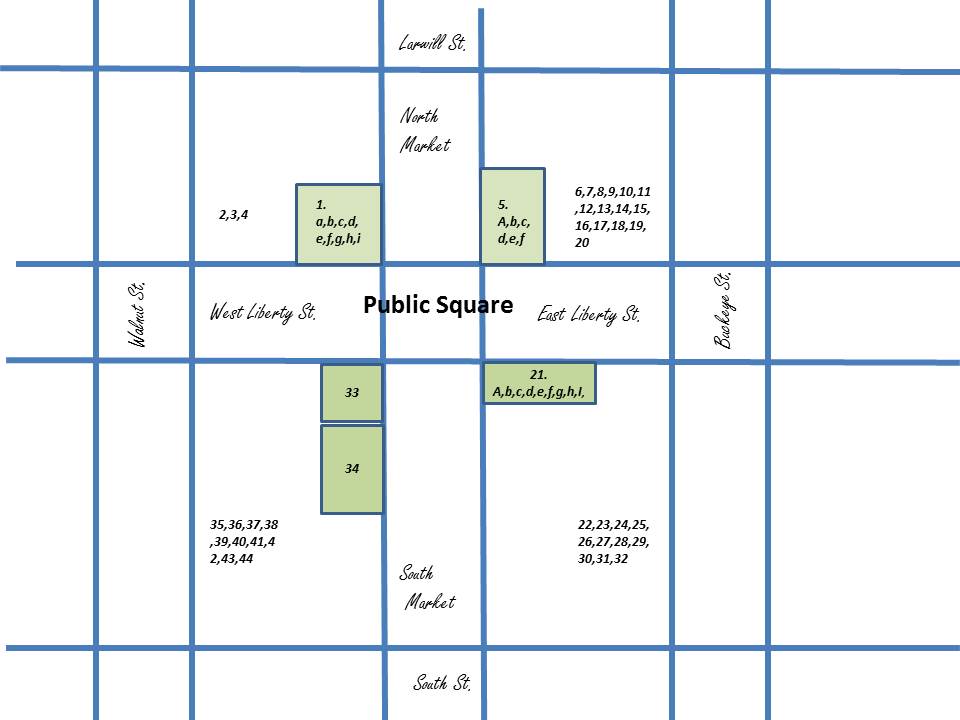
| 11:47, 14 March 2018 | PS18845map2.jpg (file) |  |
58 KB | 2. This map designed to show relative locations of businesses on Wooster's Public Square in the years 1884-1885. Numbers indicate the main floor businesses in each location that is listed in the text and the letters in text indicate businesses located... |
| 11:27, 14 March 2018 | PS 188485 map.jpg (file) |  |
58 KB | This map designed to show relative locations of businesses on Wooster's Public Square in the years 1884-1885. Numbers indicate the main floor businesses in each location that is listed in the text and the letters in text indicate businesses located on... |
| 12:31, 31 January 2018 | PS 188485update map.jpg (file) |  |
57 KB | |
| 12:14, 31 January 2018 | PS 188485jpg map.jpg (file) |  |
55 KB | Update |
| 12:51, 13 December 2017 | PS 18591860 map.jpg (file) |  |
59 KB | Wooster, Ohio Public Square 1859-1860. Letters and numbers refer to the businesses and offices in text portion of this listing. Numbers and letters within green areas show exact locations. Numbers outside of green areas refer to businesses that had no... |
| 12:40, 13 December 2017 | PS 185960 map.jpg.jpg (file) |  |
59 KB | |
| 12:12, 13 December 2017 | PS 185960 map.pptx.jpg (file) |  |
59 KB | |
| 12:49, 6 December 2017 | PS 185960 map.pdf (file) |  |
162 KB | This map is approximate locations only. Addresses were not specifed. Only locations in relation to Public Square. |