File:Wayne+Holmes Map.jpg
Jump to navigation
Jump to search

Size of this preview: 463 × 599 pixels. Other resolution: 185 × 240 pixels.
Original file (2,550 × 3,300 pixels, file size: 314 KB, MIME type: image/jpeg)
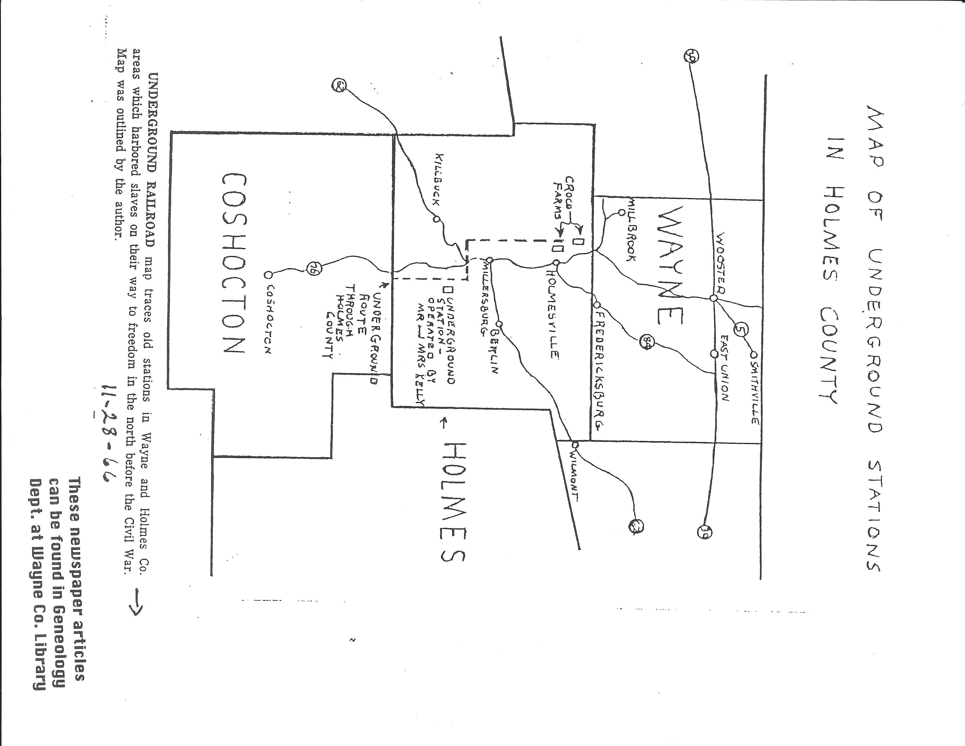
A map containing several Underground Railroad stations in Wayne and Holmes County.
File history
Click on a date/time to view the file as it appeared at that time.
| Date/Time | Thumbnail | Dimensions | User | Comment | |
|---|---|---|---|---|---|
| current | 16:29, 27 July 2022 | | 2,550 × 3,300 (314 KB) | Intern22 (talk | contribs) |
You cannot overwrite this file.
File usage
The following page uses this file: