File:USALandPatent-R14T18S09N-half-01.jpg
Jump to navigation
Jump to search

Size of this preview: 800 × 518 pixels. Other resolutions: 320 × 207 pixels | 3,097 × 2,006 pixels.
Original file (3,097 × 2,006 pixels, file size: 2.96 MB, MIME type: image/jpeg)
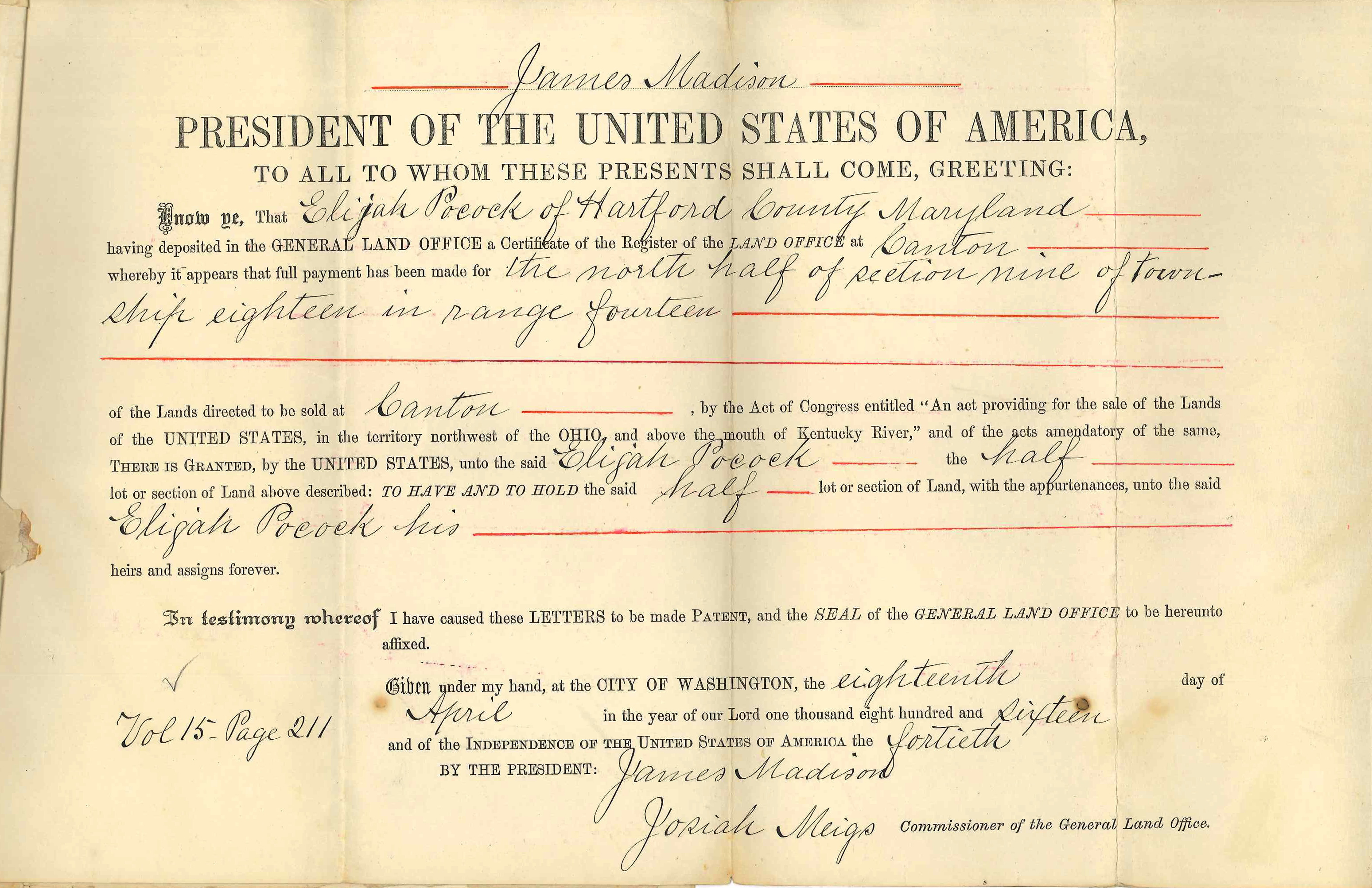
Official copy of Land Patent from the Department of the Interior, General Land Office Commissioner William A. J. Sparks dated March 30, 1886 for the United States to Elijah Pocock for Range 14, Township 18, Section 9, N-half in Wayne County, Ohio.
Original land patent held by the Wayne County Historical Society of Ohio.
See also accompanying letter:

File history
Click on a date/time to view the file as it appeared at that time.
| Date/Time | Thumbnail | Dimensions | User | Comment | |
|---|---|---|---|---|---|
| current | 12:43, 24 August 2017 | | 3,097 × 2,006 (2.96 MB) | Szimmerman (talk | contribs) | Official copy of Land Patent from the Department of the Interior, General Land Office Commissioner William A. J. Sparks dated March 30, 1886 for the United States to Elijah Pocock for Range 14, Township 18, Section 9, N-half in Wayne County, Ohio.<br/>... |
You cannot overwrite this file.
File usage
The following page uses this file: