File:USALandPatent-R13T15S03NWQRT-01.jpg
Jump to navigation
Jump to search
Size of this preview: 800 × 506 pixels. Other resolutions: 320 × 203 pixels | 3,172 × 2,008 pixels.
Original file (3,172 × 2,008 pixels, file size: 2.28 MB, MIME type: image/jpeg)
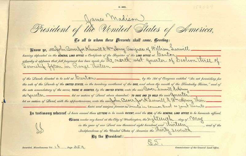
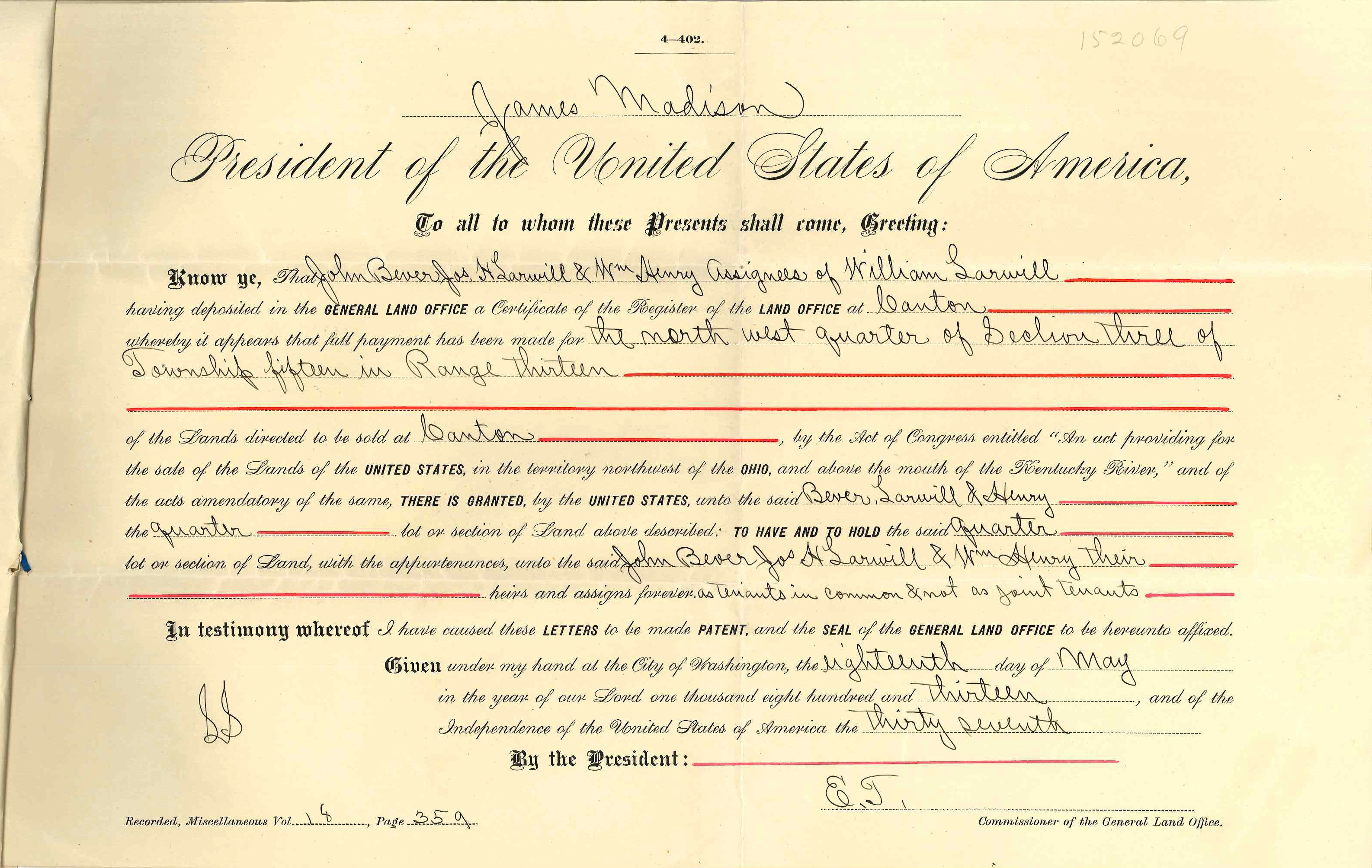
Official copy of Land Patent from the Department of the Interior, General Land Office Recorder, dated August 25, 1904 for the United States to John Bever, Joseph H. Larwill, William Henry, assignees of William Larwill for Range 13, Township 15, Section 3, NW QRT in Wayne County, Ohio.
Original copy of land patent held by the Wayne County Historical Society of Ohio.
See also accompanying letter:

File history
Click on a date/time to view the file as it appeared at that time.
| Date/Time | Thumbnail | Dimensions | User | Comment | |
|---|---|---|---|---|---|
| current | 07:03, 26 August 2017 | | 3,172 × 2,008 (2.28 MB) | Szimmerman (talk | contribs) | Official copy of Land Patent from the Department of the Interior, General Land Office Recorder, dated August 25, 1904 for the United States to John Bever, Joseph H. Larwill, William Henry, assignees of William Larwill for Range 13, Township 15, Section... |
You cannot overwrite this file.
File usage
The following page uses this file: