File:PS 1894-1895PSqmap4wiki.jpg
Original file (960 × 720 pixels, file size: 45 KB, MIME type: image/jpeg)
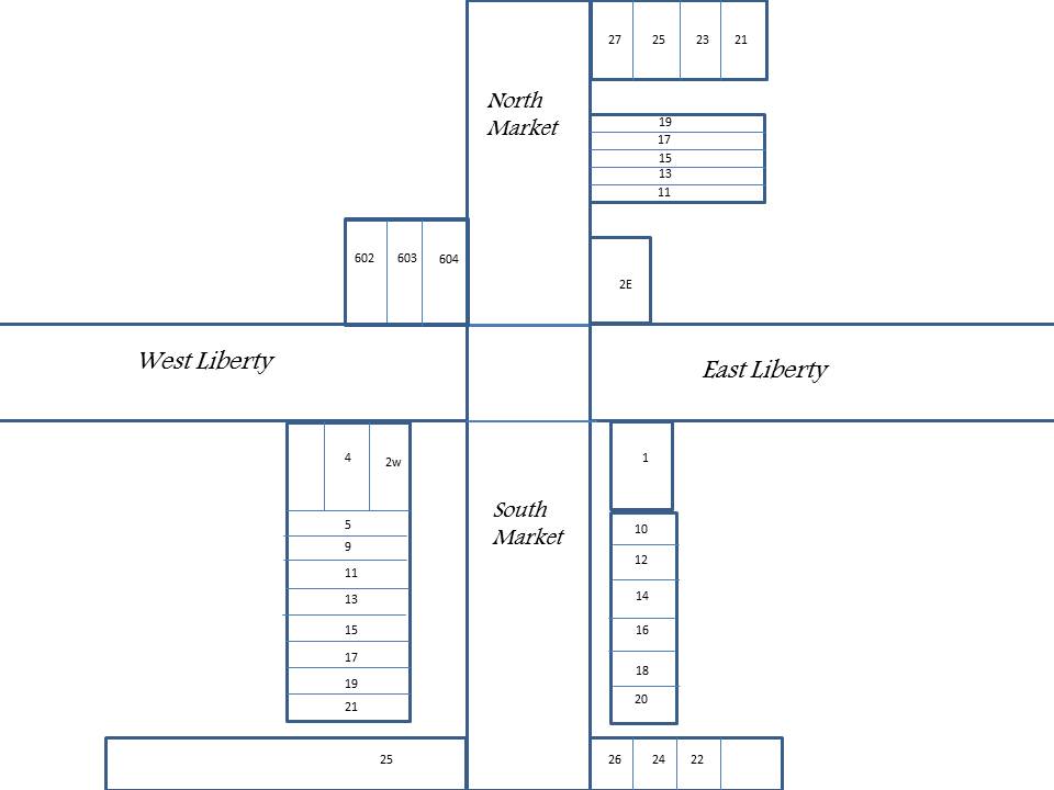
This map approximates locations of businesses on Wooster Public Square in 1894-1895. Building sizes may be slightly off as well as precise locations of businesses due to lack of immediate information. Business locations have been approximated and designated as closely as possible using sources such as Sanborn Fire Insurance maps, Harry S. McClarran’s books; A Tribute to Wooster, and A Glimpse from the Front Porch A Bridge to the Past., and The Wooster City And Wayne County Business Directory of 1894-1895. Business list will relate to map address locations based on Sanborn Fire Maps. Where the exact location is unknown, the location as related to Public Square will be indicated.
File history
Click on a date/time to view the file as it appeared at that time.
| Date/Time | Thumbnail | Dimensions | User | Comment | |
|---|---|---|---|---|---|
| current | 13:07, 16 May 2018 | | 960 × 720 (45 KB) | Volunteer8 (talk | contribs) | This map approximates locations of businesses on Wooster Public Square in 1894-1895. Building sizes may be slightly off as well as precise locations of businesses due to lack of immediate information. Business locations have been approximated and desig... |
You cannot overwrite this file.
File usage
The following page uses this file: