File:Map of California NA.png
Jump to navigation
Jump to search
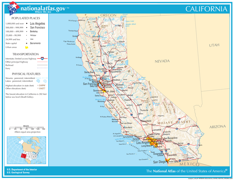
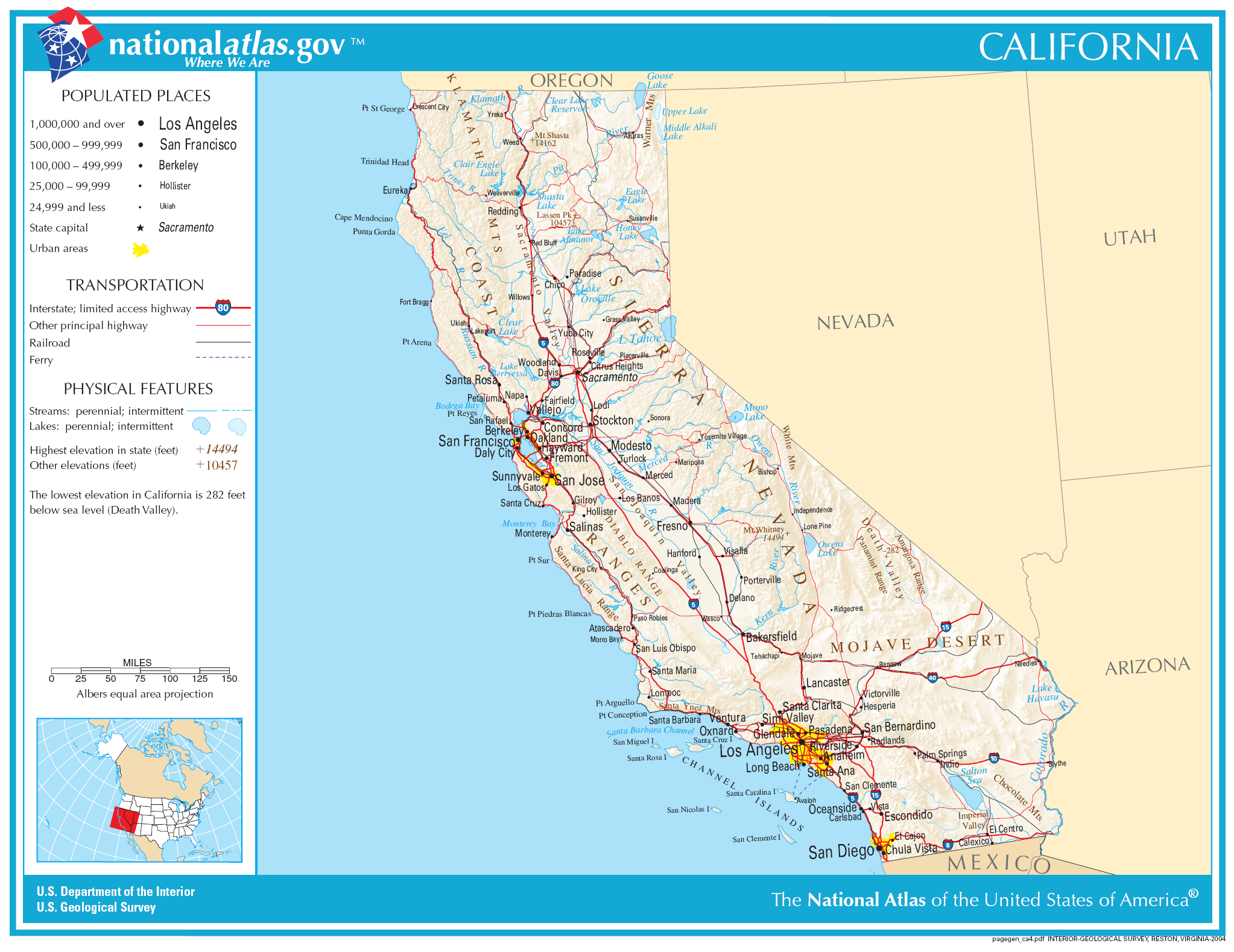
Size of this preview: 777 × 600 pixels. Other resolutions: 311 × 240 pixels | 622 × 480 pixels | 995 × 768 pixels | 1,280 × 988 pixels | 2,046 × 1,579 pixels.
Original file (2,046 × 1,579 pixels, file size: 1.48 MB, MIME type: image/png)
Summary
| Description | |
| Date | |
| Source | |
| Author | National Atlas of the United States |
| Permission (Reusing this file) |
Public domain |
Licensing
This map was obtained from an edition of the National Atlas of the United States. Like almost all works of the U.S. federal government, works from the National Atlas are in the public domain in the United States.
Online access: NationalAtlas.gov | 1970 print edition: Library of Congress, Perry-Castañeda Library
|
File history
Click on a date/time to view the file as it appeared at that time.
| Date/Time | Thumbnail | Dimensions | User | Comment | |
|---|---|---|---|---|---|
| current | 02:34, 30 November 2006 | | 2,046 × 1,579 (1.48 MB) | Jengod | Crop to reduce excess whitespace on border |
File usage
The following 2 pages use this file: