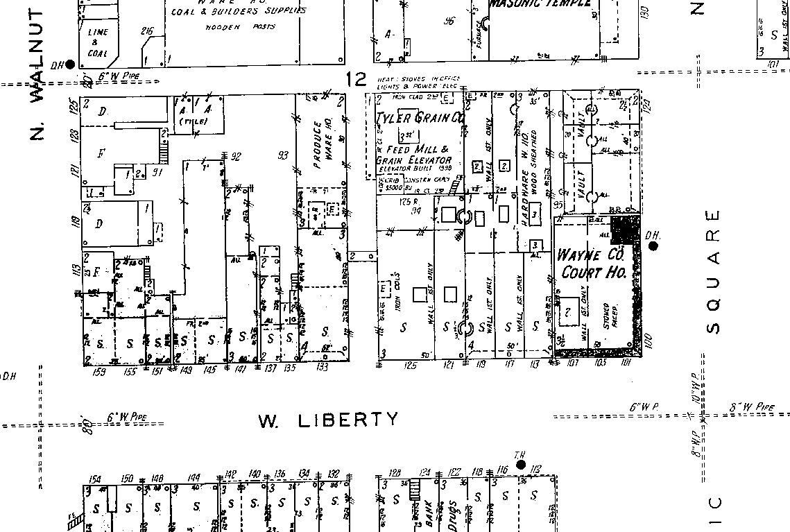
File:1930 Sanborn Map 159 W. Liberty St. Wooster, OH.png
Jump to navigation
Jump to search


Size of this preview: 800 × 539 pixels. Other resolutions: 320 × 215 pixels | 1,139 × 767 pixels.
Original file (1,139 × 767 pixels, file size: 48 KB, MIME type: image/png)

Map
| Date | 1930 |
| Organization name | |
| Industry Sector |
|
| Year | 1930 |
| Publisher | Sanborn Map & Publishing Co. |
File uploaded with MsUpload
File history
Click on a date/time to view the file as it appeared at that time.
| Date/Time | Thumbnail | Dimensions | User | Comment | |
|---|---|---|---|---|---|
| current | 13:13, 27 January 2016 | | 1,139 × 767 (48 KB) | DummyUser (talk | contribs) | File uploaded with MsUpload |
You cannot overwrite this file.
File usage
The following page uses this file: