File:USALandPatent-R14T20S35SWQRT.jpg
Jump to navigation
Jump to search

Size of this preview: 800 × 507 pixels. Other resolution: 3,043 × 1,927 pixels.
Original file (3,043 × 1,927 pixels, file size: 6.17 MB, MIME type: image/jpeg)
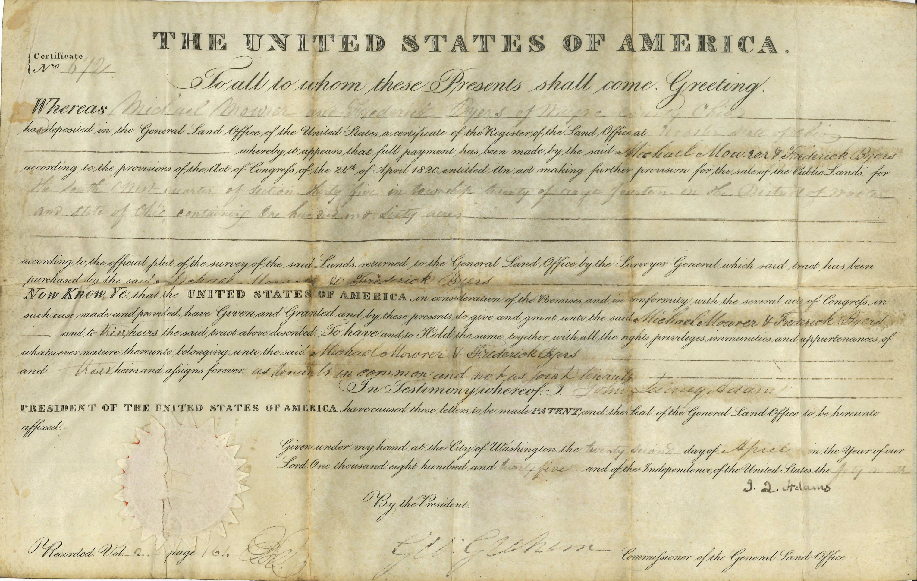
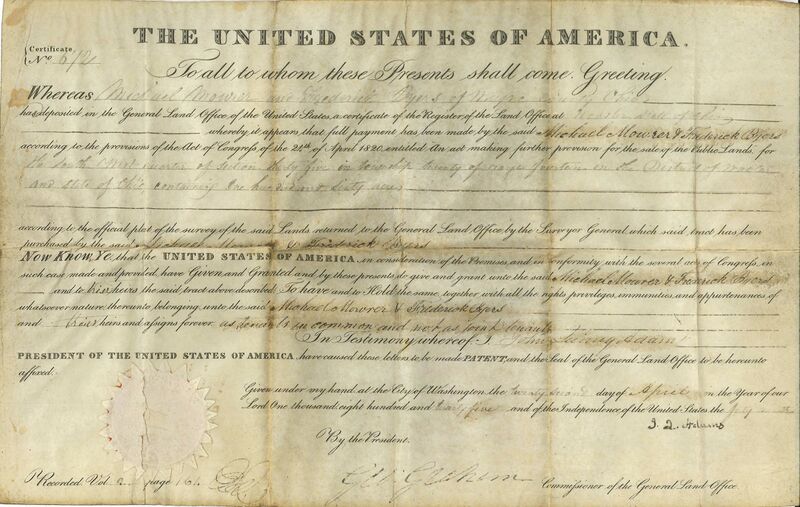
United States Land Patent to Michael Mowrer and Frederick Byers for Range 14, Township 20, Section 35 SW QRT in Wayne County Ohio. Original land patent held by the Wayne County Historical Society of Ohio.
File history
Click on a date/time to view the file as it appeared at that time.
| Date/Time | Dimensions | User | Comment | |
|---|---|---|---|---|
| current | 13:01, 12 December 2018 | 3,043 × 1,927 (6.17 MB) | Szimmerman (talk | contribs) | United States Land Patent to Michael Mowrer and Frederick Byers for Range 14, Township 20, Section 35 SW QRT in Wayne County Ohio. Original land patent held by the Wayne County Historical Society of Ohio. |
You cannot overwrite this file.
File usage
The following page uses this file: