File:USALandPatent-R14T21S01SWQRT.jpg
Jump to navigation
Jump to search
Size of this preview: 800 × 500 pixels. Other resolutions: 320 × 200 pixels | 2,561 × 1,600 pixels.
Original file (2,561 × 1,600 pixels, file size: 2.4 MB, MIME type: image/jpeg)
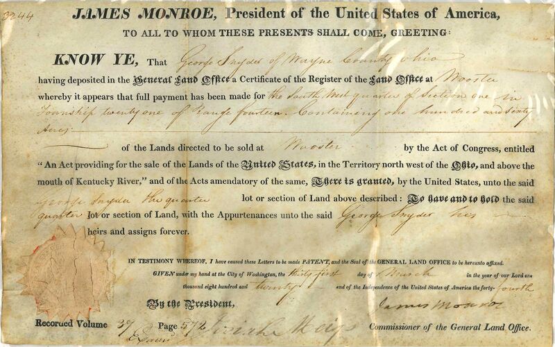
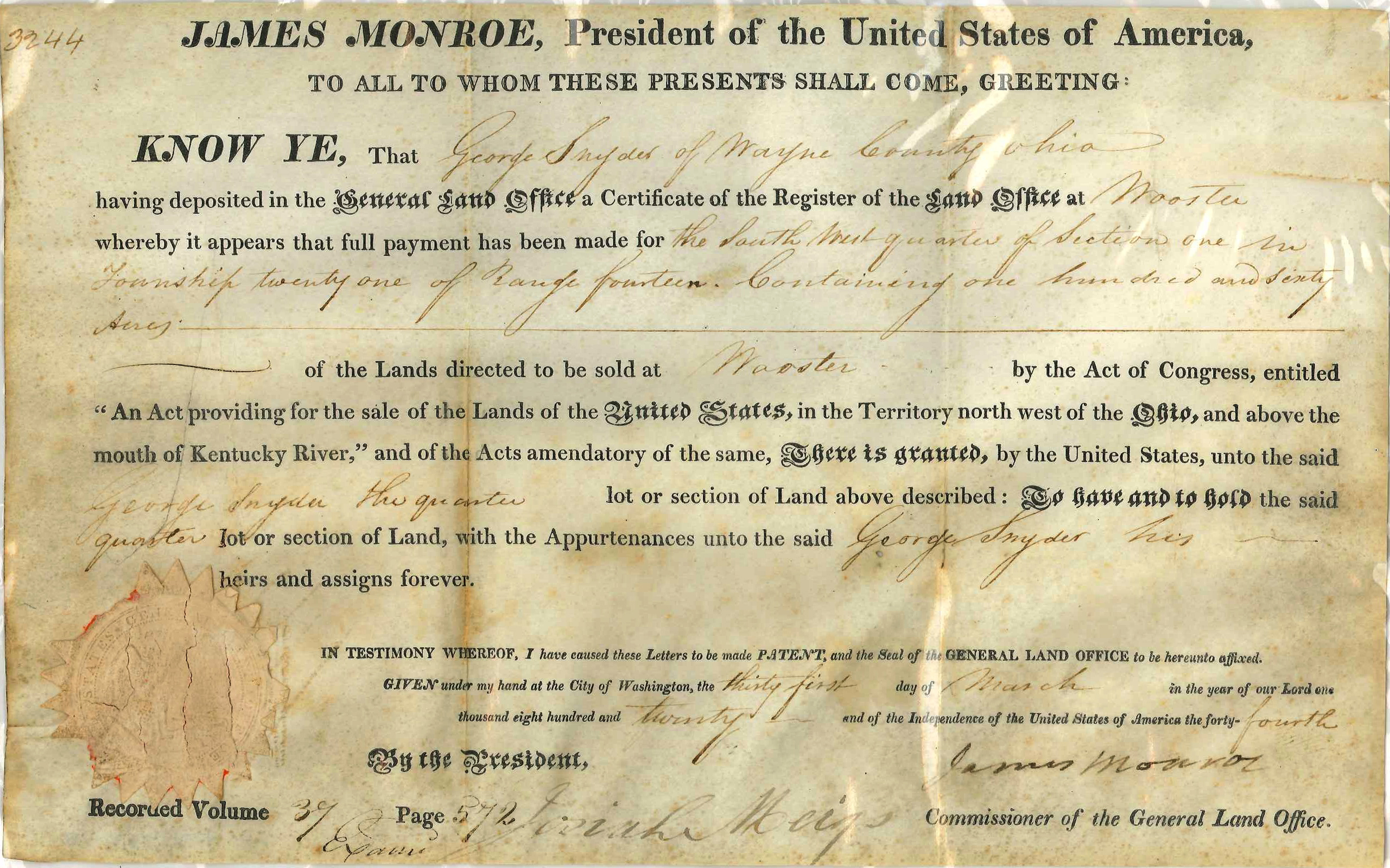
United States Land Patent to George Snyder for Range 14, Township 21, Section 1 SW QRT, containing 160 acres in Wayne County, Ohio.
Original land patent held by the Wayne County Historical Society of Ohio.
File history
Click on a date/time to view the file as it appeared at that time.
| Date/Time | Thumbnail | Dimensions | User | Comment | |
|---|---|---|---|---|---|
| current | 06:37, 26 August 2017 | | 2,561 × 1,600 (2.4 MB) | Szimmerman (talk | contribs) | United States Land Patent to George Snyder for Range 14, Township 21, Section 1 SW QRT, containing 160 acres in Wayne County, Ohio.<br/> <em>Original land patent held by the Wayne County Historical Society of Ohio.</em> |
You cannot overwrite this file.
File usage
The following page uses this file: