File:1900 Wooster Ohio map.jpg
Jump to navigation
Jump to search
Size of this preview: 800 × 600 pixels. Other resolutions: 320 × 240 pixels | 960 × 720 pixels.
Original file (960 × 720 pixels, file size: 46 KB, MIME type: image/jpeg)
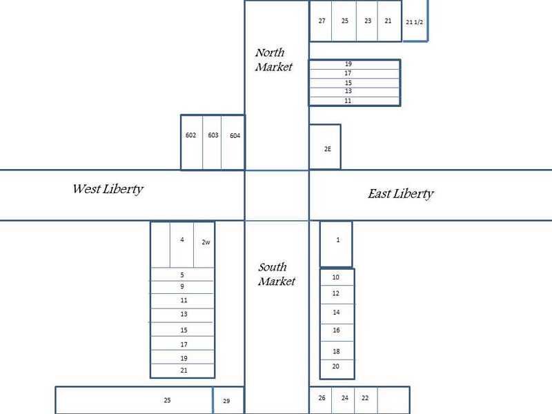
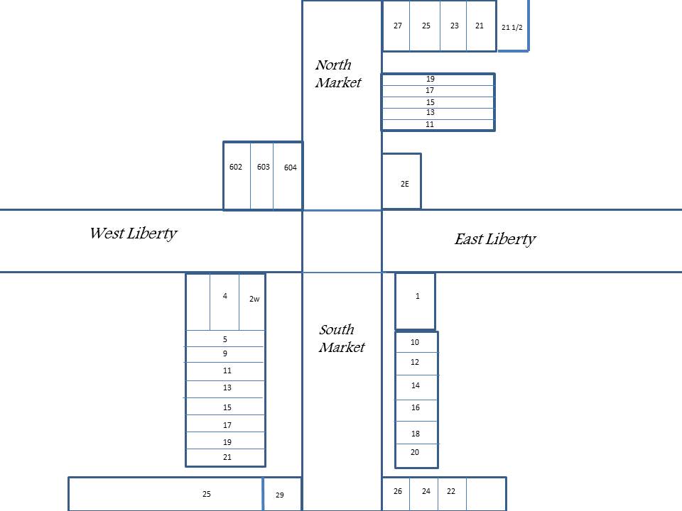
This map created to show approximate locations of Wooster Public Square businesses in the year 1900. Numbers in listing refer to numbers of the map buildings.
File history
Click on a date/time to view the file as it appeared at that time.
| Date/Time | Thumbnail | Dimensions | User | Comment | |
|---|---|---|---|---|---|
| current | 11:23, 22 August 2018 | | 960 × 720 (46 KB) | Volunteer8 (talk | contribs) | This map created to show approximate locations of Wooster Public Square businesses in the year 1900. Numbers in listing refer to numbers of the map buildings. |
You cannot overwrite this file.
File usage
The following page uses this file: