File:1856BakersMapWoosterTwp.jpg
Jump to navigation
Jump to search


Size of this preview: 624 × 600 pixels. Other resolutions: 250 × 240 pixels | 2,336 × 2,246 pixels.
Original file (2,336 × 2,246 pixels, file size: 4.01 MB, MIME type: image/jpeg)

Map
| Date | 1856 |
| Organization name | |
| Year | 1856 |
| Publisher | Baker's |
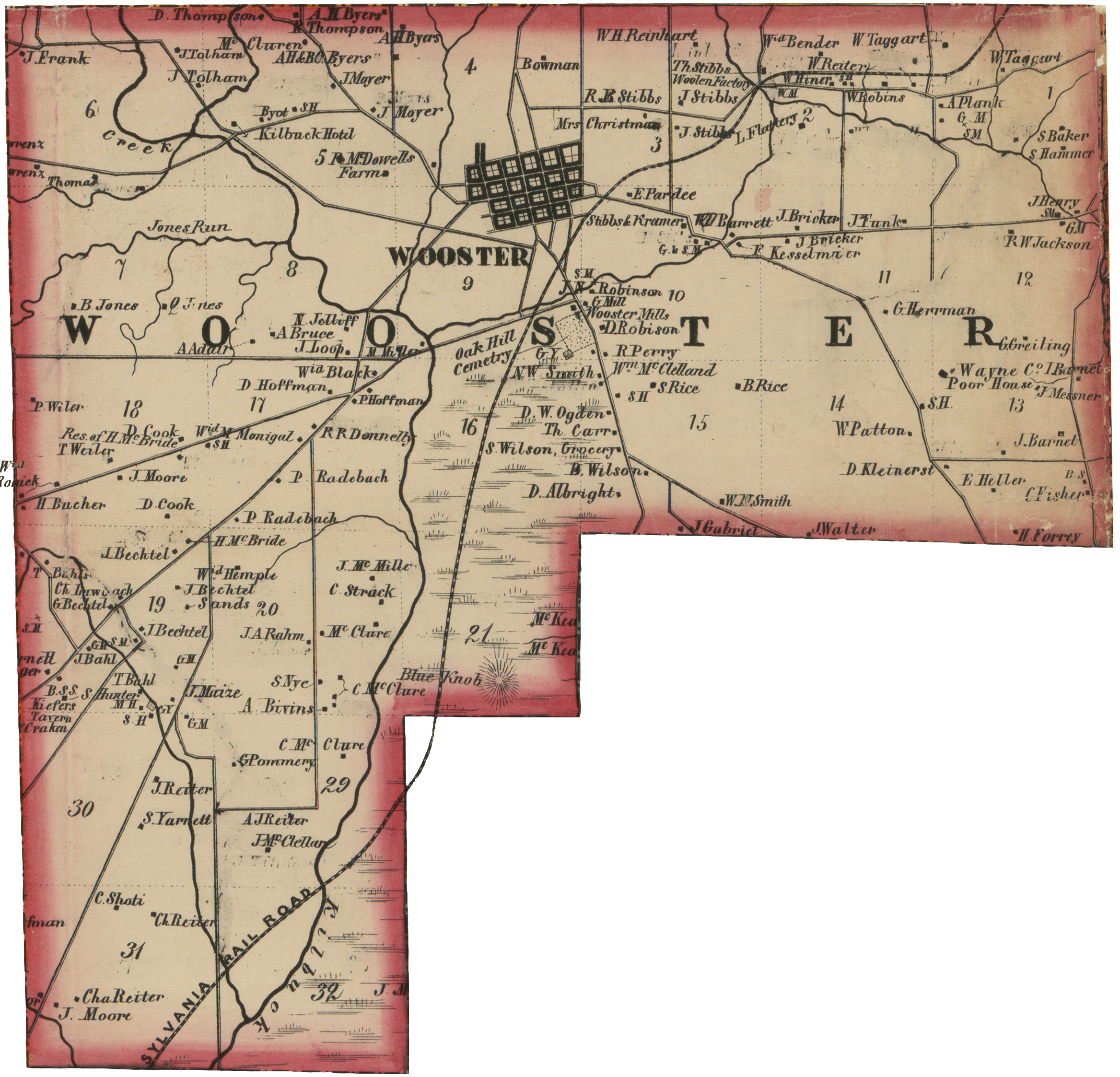
| Full text | Image of Wooster Township section of the 1856 Baker's Map of Wayne County, Ohio. Original image source from the Library of Congress copy of the map. |
File history
Click on a date/time to view the file as it appeared at that time.
| Date/Time | Thumbnail | Dimensions | User | Comment | |
|---|---|---|---|---|---|
| current | 09:52, 29 October 2017 | | 2,336 × 2,246 (4.01 MB) | Szimmerman (talk | contribs) | Image of Wooster Township section of the 1856 Baker's Map of Wayne County, Ohio. Original image source from the Library of Congress copy of the map. |
You cannot overwrite this file.
File usage
The following 2 pages use this file: