File:USALandPatent-R11T16S03SEQRT-01.jpg
Revision as of 07:56, 20 August 2017 by Szimmerman (talk | contribs)
Size of this preview: 373 × 600 pixels. Other resolutions: 149 × 240 pixels | 1,221 × 1,964 pixels.
Original file (1,221 × 1,964 pixels, file size: 951 KB, MIME type: image/jpeg)
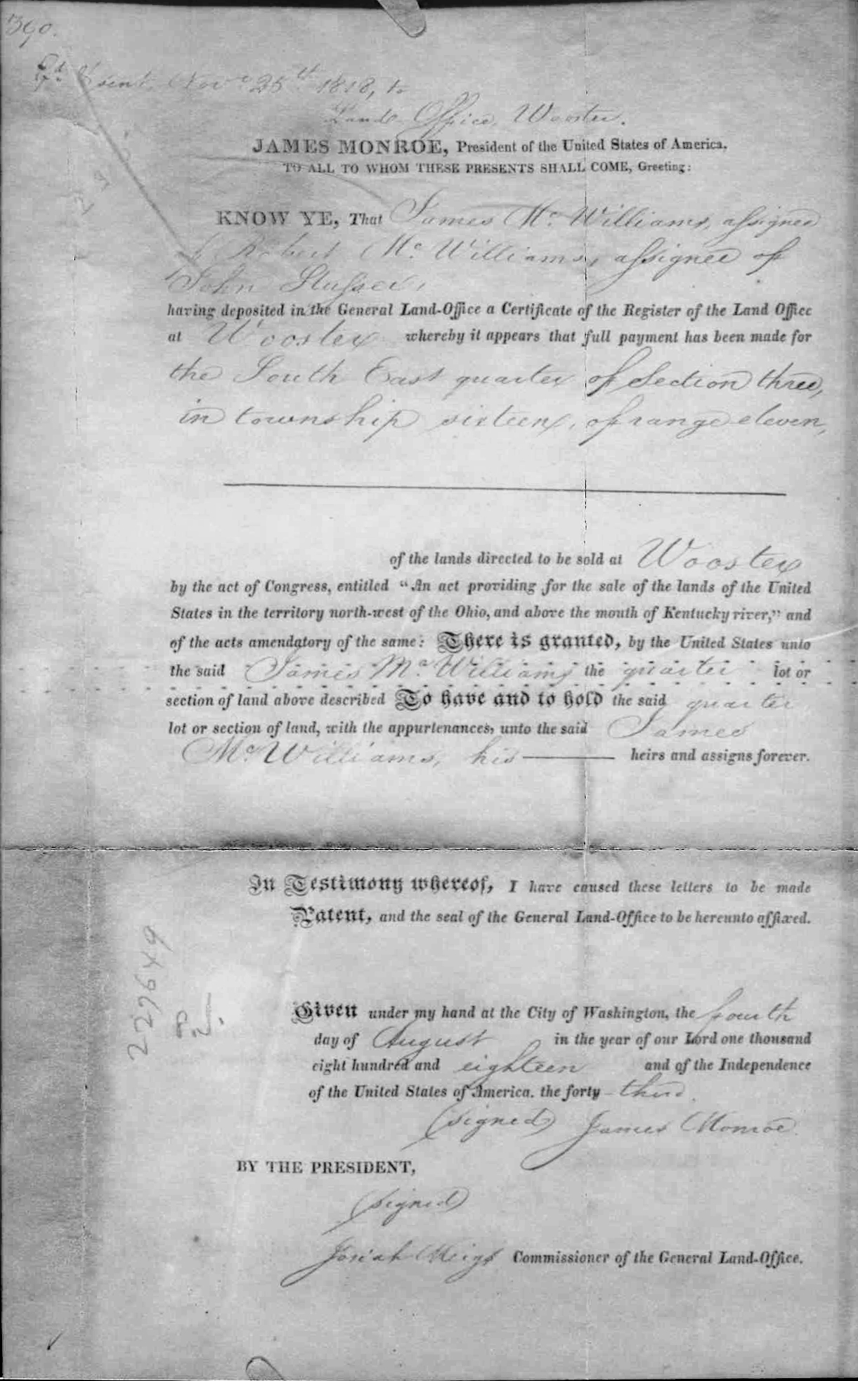
Official copy of Land Patent from Department of the Interior, General Land Office Acting Record, John O'Connell dated February 10, 1910, from USA To James McWilliams for Range 11, Township 16, Section 3, SE QRT in Wayne County, Ohio.
Original copy of land patent held by the Wayne County Historical Society of Ohio.
File history
Click on a date/time to view the file as it appeared at that time.
| Date/Time | Thumbnail | Dimensions | User | Comment | |
|---|---|---|---|---|---|
| current | 07:42, 20 August 2017 | | 1,221 × 1,964 (951 KB) | Szimmerman (talk | contribs) | Official copy of Land patent from Department of the Interior, General Land Office Acting Record, John O'Connell dated February 10, 1910, from USA To James McWilliams for Range 11, Township 16, Section 3, SE QRT. |
You cannot overwrite this file.
File usage
The following page uses this file: